

Nicole Kieninger
Wir hatten als Familie eine 2-stündige Quadtour, gebucht und wurden sehr positiv überrascht. Die Söhne sind 16 und 19 und daher selbst gefahren. Wir hatten als Familie zwei Guides und waren für uns, es gab also keine große Gruppe, bei der immer auf jemanden gewartet werden musste, sondern nur auf mich ;-) und hier hatten sich die Guides dann abgesprochen. Der Spaß war entsprechend groß. Bei der 2-stündigen Tour konnten wir vom höchsten Punkt Koh Samuis die Landschaft bewundern und den großen Buddha. Der Fahrspaß war so groß, dass meine Männer nochmals eine 1-Stündige Tour gebucht haben nur um nochmals fahren zu können und auch hier waren sie allein als Gruppe unterwegs. Man sollte dabei jedoch nicht empfindlich sein, was Dreck angeht, denn der Sand wird ordentlich aufgewirbelt. Da wir schon in vielen Urlauben ähnliche Ausflüge gebucht hatten, können wir sagen, dass diese Quadtouren die bisher Besten waren und kaum zu toppen sind.

Ed Lees
Great half day tour, from booking the night before for a next morning trip everything was well communicated and very promptly. The tour itself was made so much better by our guide and driver who took great care of us for the whole trip. Our guide was knowledgeable, courteous and interacted with us for the majority of the trip. Would recommend 👍🏻

Nicole Haas
Wir haben heute die Tour zum Angthong NationalPark gemacht. Die Tour ist sehr gut organisiert. Sehr nettes zuvorkommendes Personal, gutes Essen. Ich habe meine Schuhe im Bus vergessen. Eine Stunde später konnte ich sie schon an der Rezeption abholen. Einfach klasse. Vielen Dank für diesen tollen Tag.

אופיר סויסה
רוצה להודות ולהמליץ על שליו מסיאם טורס על תכנון טיול מושלם, בהקשבה מדויקת למה שאנחנו צריכים, טסנו עם תינוקת והיה ראש שקט!!!!!!!! כל המעברים היו מושלמים! ללא המתנה בכלל, תמיד בזמן ובדיוק! סבלני קשוב פשוט כיף כיף כיף! אין ספק שאת הטיול הבא הוא יתכנן!

sandie's journeys
I highly recommend picking this company for the tours they do. We went looking for pink dolphins, which we saw, snorkeling and then pig island. Lunch was included. It was a fantastic day
The viewpoint on Koh Wua Ta Lap gives you the classic view of Ang Thong Marine Park: dozens of green limestone islands rising from the Gulf of Thailand, with narrow channels of blue water running between them.
It is one of the best-known views in southern Thailand, but reaching it takes real effort. The trail is short in distance and steep almost from the beginning. In hot, humid weather, it feels much harder than its length suggests.
The climb is optional. Visitors who do not want to attempt it can remain near the national park headquarters, relax on the beach or explore the lower part of the island.
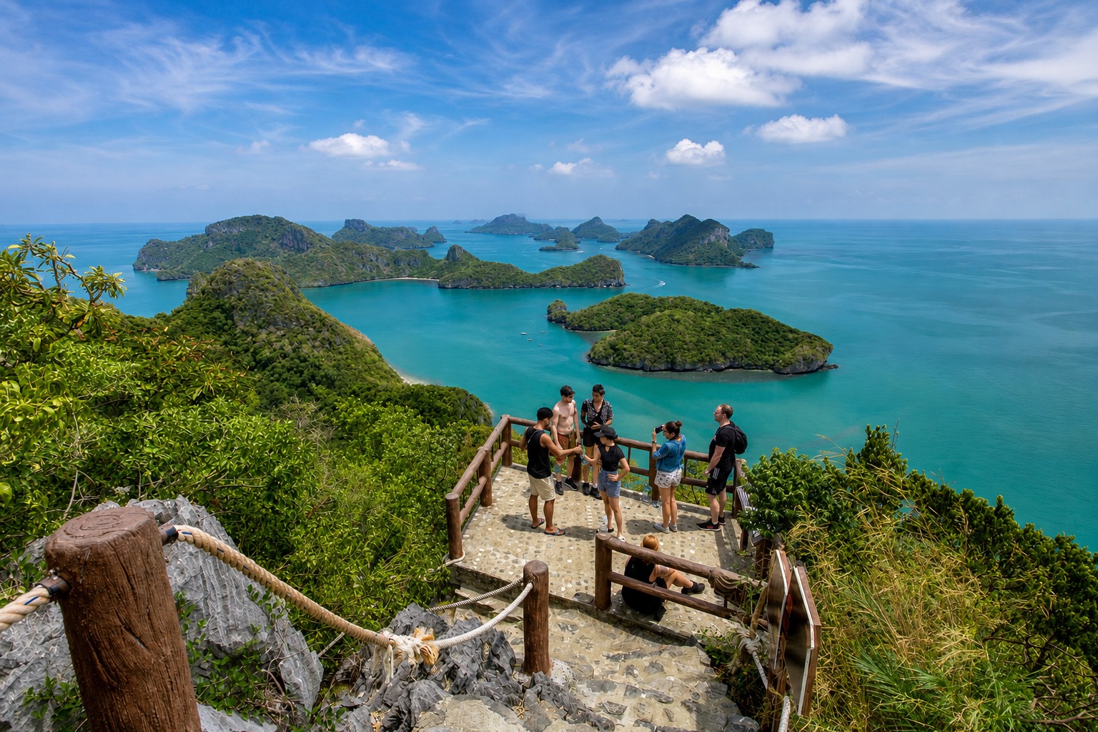
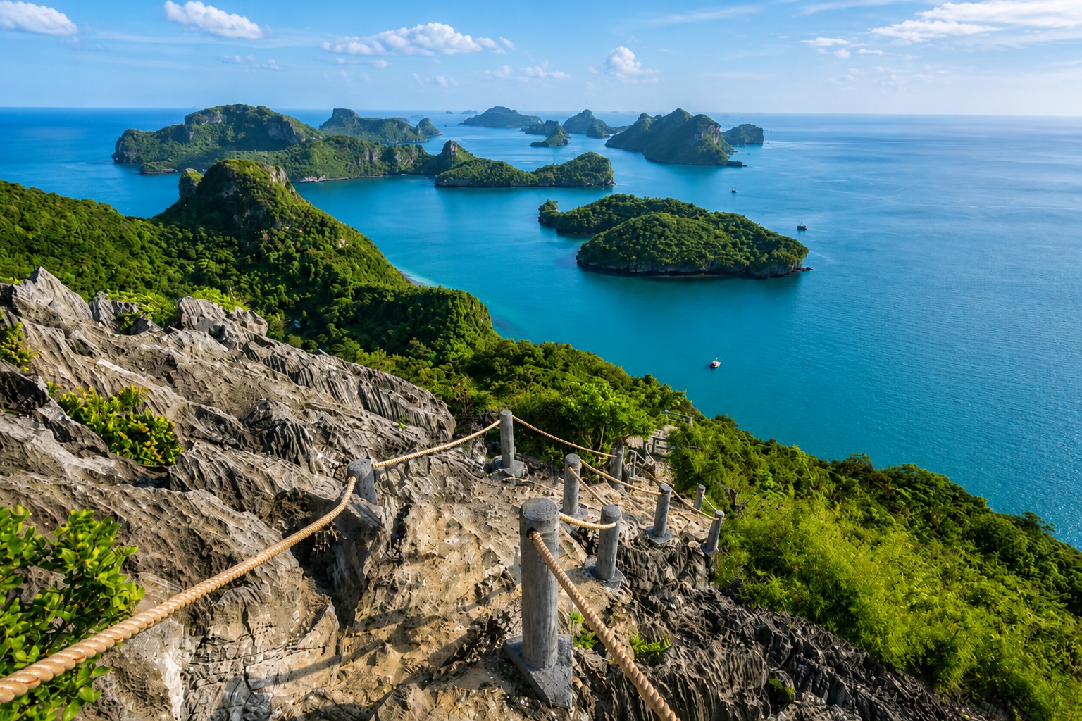
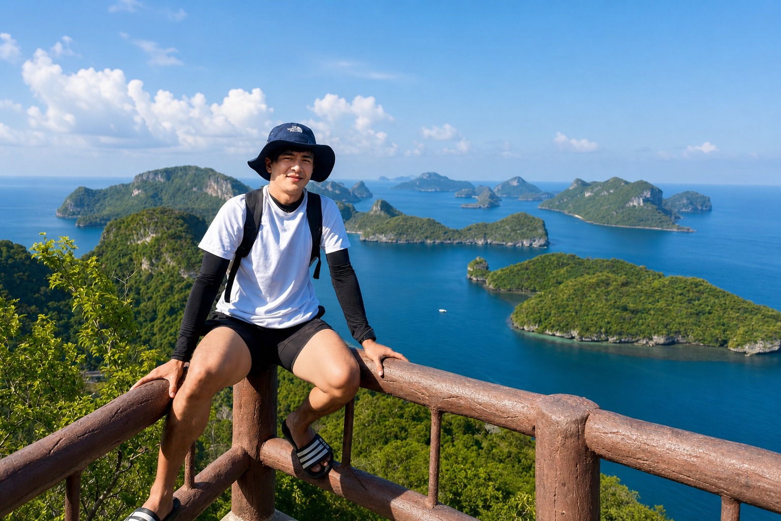
Koh Wua Ta Lap is the main visitor island in Mu Ko Ang Thong National Park. The park headquarters, ranger station and basic visitor facilities are located beside the beach.
The viewpoint is commonly called Pha Chan Charat, Pha Jun Jaras or Pha Chan Jaras in English. These are different spellings of the same Thai name rather than separate viewpoints.
The trail begins close to the headquarters area and climbs through forest and exposed limestone to a series of viewing platforms. The highest platform opens towards the central part of the archipelago.
Some sources describe it as a 500-metre trail, while current Tourism Authority of Thailand material refers to a walking route of approximately 400 metres. Either way, the important figure is the steepness, not the distance.
Do not confuse a 500-metre trail with a viewpoint 500 metres above sea level. The latter claim appears frequently online but is incorrect. The islands of Ang Thong do not reach that elevation.
This is not a gentle sightseeing path. It is a sustained climb involving steps, uneven limestone, tree roots and steep sections fitted with ropes or railings.
The lower section starts beneath the trees, but the humidity becomes noticeable quickly. As the path rises, parts of it become more exposed to direct sun.
The upper section is the hardest. The ground becomes steeper and rockier, and you may need to use the fixed rope for balance. On the way down, the same section can feel more difficult because loose stones and smooth rock are easier to slip on.
You do not need technical climbing experience. You do need reasonable mobility, balance and enough fitness to climb continuously in tropical heat.
People often underestimate the trail because it looks short on a map. A flat 500-metre walk is easy. A steep 500-metre ascent over irregular ground is a different thing entirely.
A reasonably fit visitor may reach the highest platform in about 25 to 35 minutes. Allow longer if the trail is busy, you need regular rests or the weather is particularly hot.
A sensible total allowance is 60 to 90 minutes for the climb, photographs and descent. Some people complete it faster, but rushing is not a good idea.
Your available time depends on the tour. Boats do not all spend the same amount of time at Koh Wua Ta Lap. Before starting, listen carefully to the guide’s return instructions and work backwards from the departure time.
Reaching the summit is only half of the walk. Leave enough time and energy for the descent.
Several stopping points break up the route. They provide places to catch your breath and offer progressively wider views across the beach and surrounding islands.
The lower platforms are useful if you want a view without completing the full climb. They do not show the complete archipelago panorama, but they can still be worthwhile.
As you climb higher, the beach and headquarters area become smaller beneath you. More islands appear behind the nearer ridges, and the narrow waterways between them become easier to see.
The highest platform gives the broadest view. From here, the closely grouped islands make the park’s Thai name feel appropriate. “Ang Thong” means “golden basin”, while “Mu Ko” means a group of islands.
You do not have to reach the top for the climb to count. Turn around at any platform if you are becoming unsteady, overheated or concerned about the remaining time.
For most active visitors, yes. The upper viewpoint shows the scale and layout of the park better than any view from sea level.
From a boat, the islands appear one after another and can block each other from view. From above, you can see how tightly they are grouped and how the sea runs between their limestone ridges.
The final view is also different from Emerald Lagoon on Koh Mae Ko. Emerald Lagoon looks inward over a marine lake enclosed by cliffs. Koh Wua Ta Lap looks outward across the wider archipelago.
If you can only manage one climb, the right choice depends on your ability. Emerald Lagoon is shorter and has constructed stairs, although it is still steep. Koh Wua Ta Lap is longer, rougher and physically more demanding, but its summit view is much wider.
The full trail may be unsuitable for people with:
Pregnant visitors should consider the steepness, heat and risk of slipping carefully. Parents should also assess whether a child can climb and descend independently without being carried.
Carrying a tired child on the upper trail is unsafe. It leaves you with only one hand for the rope and changes your balance on uneven ground.
There is no shame in stopping early. The beach is pleasant, and a lower platform is better than turning a holiday into an injury.
Wear trainers, hiking shoes or secure outdoor sandals with a proper heel strap and good grip.
Loose flip-flops are a poor choice. They move under the foot, offer little grip on polished rock and make the descent harder. Bare feet are also unsuitable because the limestone can be sharp.
The trail may be damp after rain. Even in dry weather, shaded rock can remain slippery.
Check your shoes before leaving the boat. A sole that has started separating or an old pair with worn tread can become a problem halfway up.
Carry water, but keep your load light. A small bottle is normally enough for the climb if you have already been drinking during the boat journey.
Useful items include:
Keep both hands available on steep sections. A backpack is better than carrying a loose beach bag or bottle in one hand.
Drink before you begin. Starting the trail already dehydrated makes the heat much harder to manage.
Heat is often the biggest challenge, not the distance.
The forest provides shade in places, but it also holds humidity. Sweat does not evaporate as efficiently, so your body has to work harder to cool itself.
Start at a steady pace. If you race through the lower section, the upper climb can become unpleasant very quickly.
Stop if you feel dizzy, nauseous, unusually weak, confused or unable to catch your breath. Move into shade, drink water and tell another person or your guide. Do not continue simply because the summit appears close.
The safest decision is sometimes to turn around.
Many visitors find the descent harder on their knees than the climb.
Face forward on ordinary steps, but turn slightly sideways where the slope is particularly steep. Use the rope or railing and place each foot carefully before transferring your weight.
Do not run to make up time. If you are late, tell the guide or another member of your group as soon as possible rather than increasing the risk of a fall.
Give space to people climbing upwards. The narrowest sections can only handle one direction comfortably at a time.
If the rock is wet, assume it is slippery.
The best time is when your boat arrives and the park permits access. Day-tour passengers usually cannot choose an exact hour.
Earlier visits tend to be cooler. Later in the day, heat stored in the exposed rock can make the trail feel tougher.
Crowds often arrive in waves because several tours follow similar schedules. If a large group has just started climbing, waiting a few minutes may create more space. Only do this if your tour schedule allows it.
Cloud cover can make the ascent more comfortable, but rain changes the situation. Wet limestone, mud and steps require much more care. Park staff or guides may restrict the route when conditions are unsafe.
The highest platform is compact, so take your photographs and then make room for other visitors.
A wide phone lens is useful for showing the full island panorama. A normal lens gives the islands more scale and usually produces a less distorted result.
Try including part of the foreground vegetation or railing to give the photograph depth. For a cleaner landscape, hold the camera slightly higher so the railing sits below the islands.
Keep your phone or camera attached to a strap on the trail. Do not walk while looking through the screen, especially during the descent.
The water does not always appear bright turquoise. Its colour changes with sunlight, cloud, wind and the angle from which you photograph it.
Koh Wua Ta Lap supports forest wildlife as well as marine birds. Visitors may see dusky leaf monkeys, sometimes called spectacled langurs, in the trees around the island. These monkeys have dark fur and pale rings around their eyes.
A sighting is not guaranteed. Look quietly into the canopy rather than trying to attract wildlife with food.
Do not feed monkeys, birds or other animals. Feeding changes their behaviour and encourages them to approach visitor areas.
You may also see butterflies, lizards and birds around the lower trail. On the climb itself, watch where you place your hands rather than reaching blindly into vegetation or rock gaps.
The viewpoint is not the only reason to stop at Koh Wua Ta Lap.
The headquarters beach is suitable for resting and swimming when conditions permit. The island also has a separate trail leading towards Bua Bok Cave, known for its limestone formations.
The cave trail should not be treated as a quick alternative to the viewpoint. It is a separate route and can also involve rough, steep ground. Most day-tour passengers will not have enough time to complete both comfortably.
Basic national park facilities are located near the beach. What is open can vary, so bring essential water and supplies from your tour boat rather than relying entirely on the island shop or restaurant.
Not every Ang Thong itinerary includes enough time for the full viewpoint climb.
Before booking, check:
Itineraries may change because of weather, waves, park instructions or safety concerns. A tour can plan to visit Koh Wua Ta Lap without being able to guarantee the summit trail every day.
Route information checked August 2026. Trail access and conditions can change, so follow current instructions from national park staff and your tour guide.
Official tourism material describes a route of approximately 400 to 500 metres. It is short but very steep.
No. The frequently repeated figure refers to the approximate trail distance, not the elevation above sea level.
Allow about 25 to 45 minutes to climb, depending on fitness, heat and crowds. A complete visit with the descent and photographs commonly takes 60 to 90 minutes.
Yes. Intermediate stopping points offer partial views, so you can turn around before the highest platform and still see the beach and nearby islands.
It is possible to see people attempting it, but flip-flops are not suitable. Wear trainers or secure sandals with good grip.
It depends on the child’s fitness, balance and ability to manage steep ground independently. Carrying a tired child on the upper route is unsafe.
Yes. It involves a sustained steep climb, irregular steps, exposed limestone and sections where fixed ropes help with balance.
No. Emerald Lagoon is on Koh Mae Ko. The Koh Wua Ta Lap viewpoint overlooks the wider Ang Thong archipelago.
Yes. The climb is optional, and visitors can normally remain around the headquarters and beach area.
No. Check the current itinerary and the length of the island stop before booking.